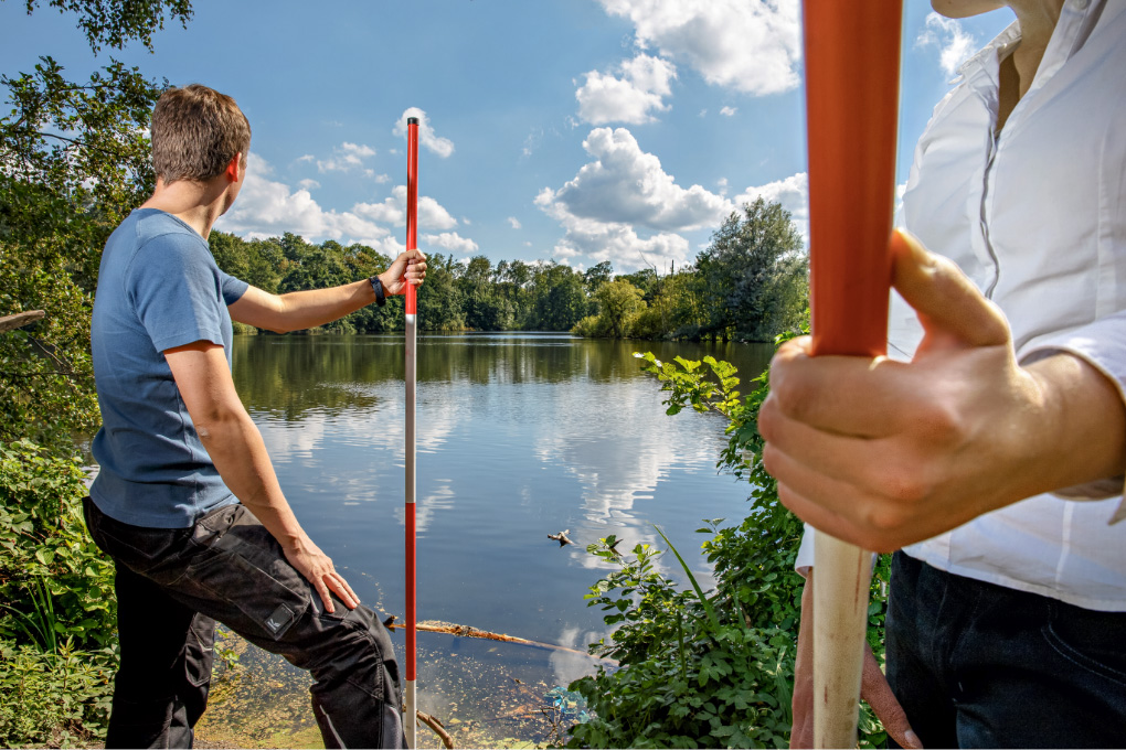
As part of the MuSE project, Professor Dr Rudolph and his team are focusing on the economic and technical (re-)assessment of polder management by means of multisensor geomonitoring. Dr Xiaoxuan Yin, a specialist in the field of radio interferometry and remote sensing, joined the Research Center of Post-Mining for the project and explains the approach: ‘We use various sensors to measure the ground moisture. At the same time, we evaluate data in the areas surrounding the two most recently active mines in the Ruhr area, Prosper-Haniel in Bottrop and Auguste Victoria in Marl, and explore the vegetation with our drones. We compare the information at the sites with remote sensor data from the European Copernicus satellite programme and are evaluating them for the first time for this issue.’ Dr Yin combines the many different sources of information in a 4D model with time as the fourth dimension. This enables the tracing and digital modelling of the changes of the water balance and their effects on the environment over the decades.

Developing solutions with science
Right: Globally relevant research
The findings from the MuSE project contribute to improving environmental conditions in agriculture, forestry and water management – even beyond the former coal mining regions. © THGA/Volker Wiciok
Left: Field research
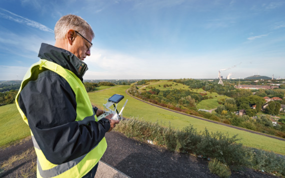
Dr Bodo Bernsdorf regularly sends up drones with special sensors in the region. © THGA/Volker Wiciok
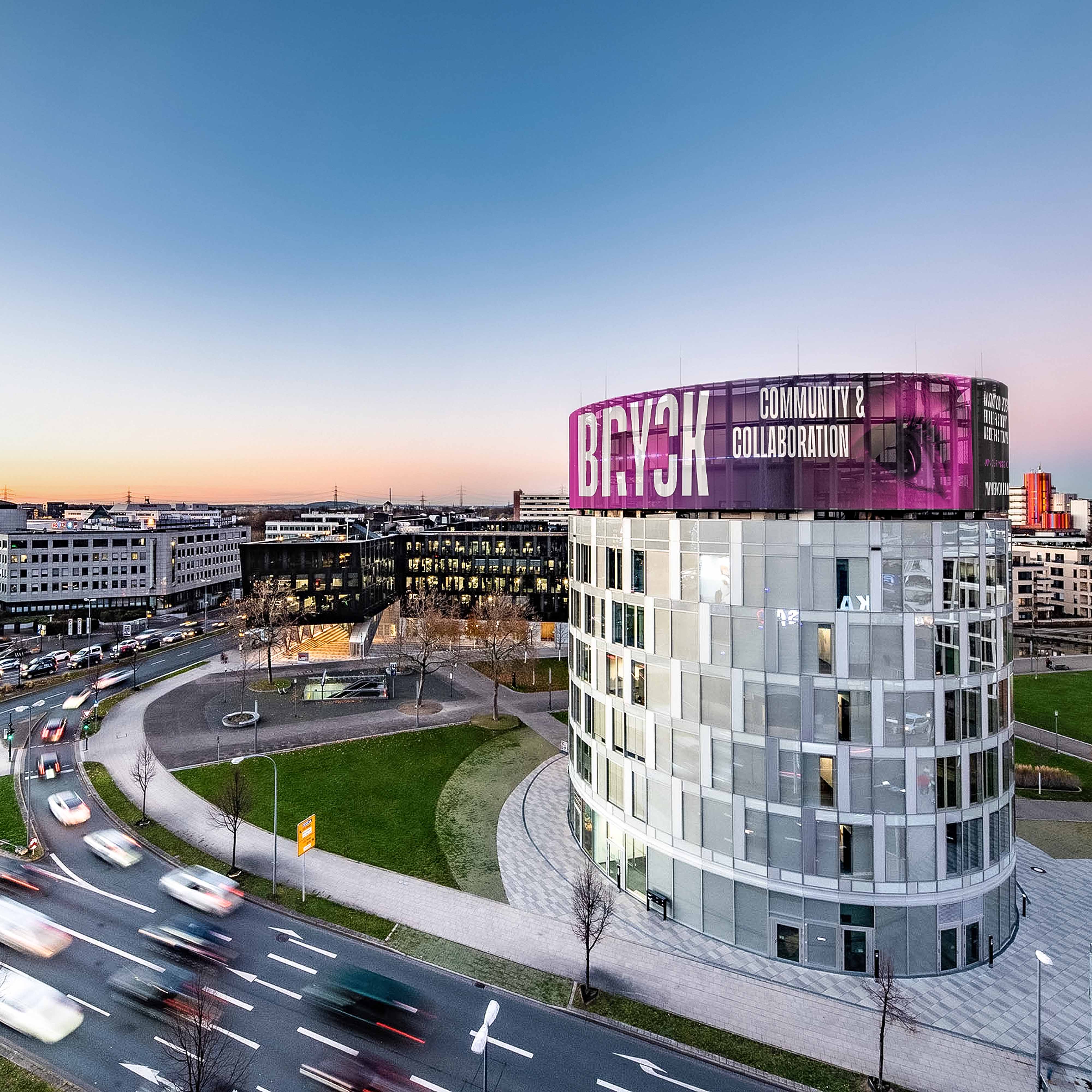
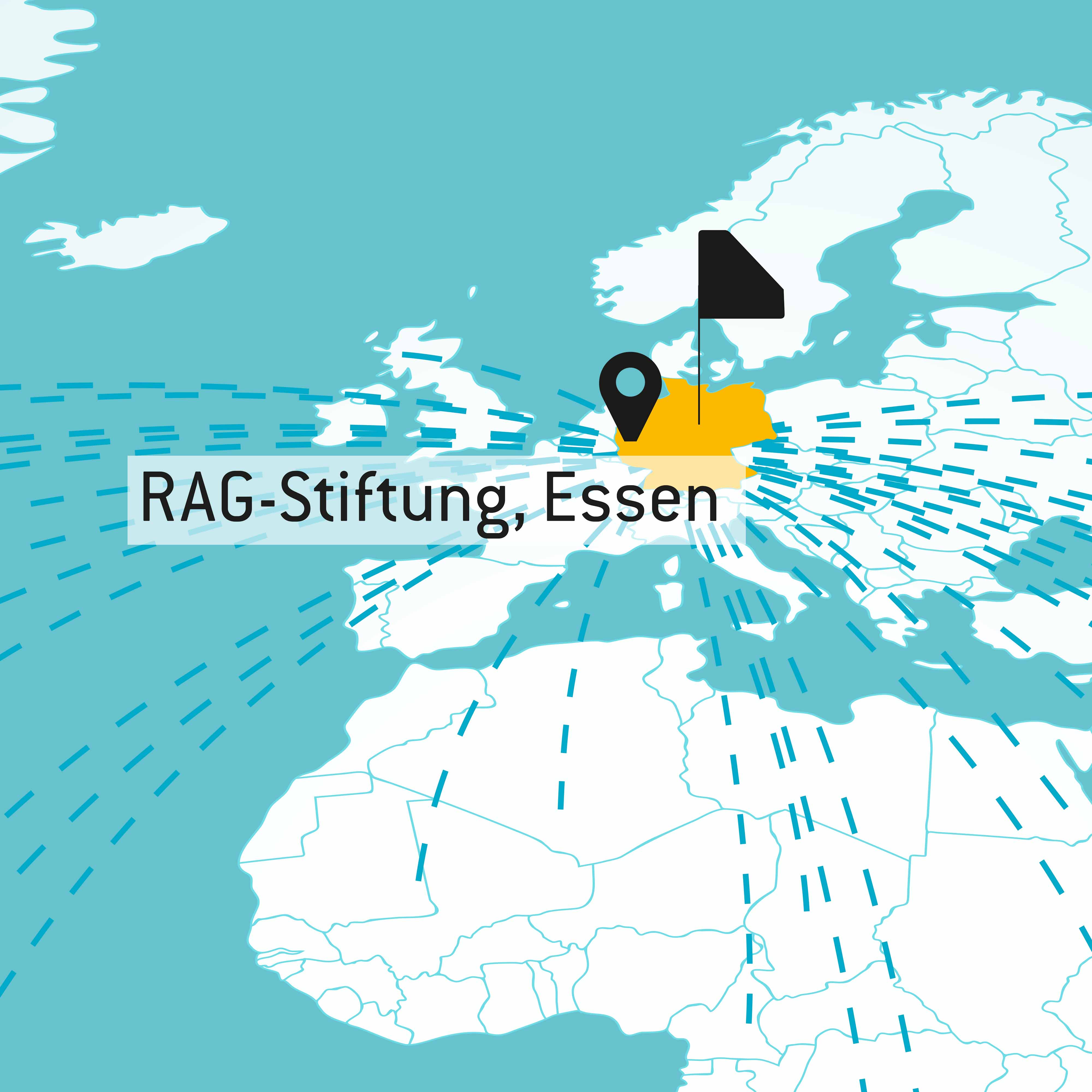
How can water management in the former mining regions along the Ruhr and Saar rivers and in Ibbenbüren be made even more sustainable? The Research Center of Post-Mining is addressing this question – and finding innovative solutions recognised internationally along the way. One example of these solutions is the MuSE project, launched in 2021, for multisensor geomonitoring to optimise post-mining water management, which is supported by the RAG-Stiftung.
The perpetual obligations
While in other parts of the world – China and Colombia, for instance – the end of coal mining is still on the horizon, they often look to the Ruhr region: the Forschungszentrum Nachbergbau (Research Center of Post-Mining/ FZN) at the Technische Hochschule Georg Agricola (THGA) in Bochum is a leader in this field. The FZN is the only academically independent research centre of its kind for the field of post-mining. Among other topics, the centre deals with the perpetual obligations of the coal mining industry – that is, pit water management, polder measures and groundwater purification at some former coking plants. Specifically, the Research Center of Post-Mining carries out studies on water management, among other topics, investigates the effects of pit water rise on methane outgassing and optimises polder measures. The tasks of the FZN, which is home to a team of high-calibre researchers, also include geomonitoring analyses in the field of former mines and post-mining. The centre thereby also contributes to keeping groundwater clean in former mining regions and protecting aquifer ecosystems.
Among other tasks, the FZN finds solutions to issues having to do with the perpetual obligations of the German coal mining industry: pit water management, polder measures and groundwater purification. The MuSE project focuses on the sustainable realignment of polder management.
Challenges of the post-mining era
In particular with regard to so-called impoldering, the Research Center of Post-Mining addresses a key question: What does the efficient and sustainable realignment of polder management look like in the former mining regions, particularly with regard to climate change? The MuSE project, which was launched in 2021, provided one answer to this question. Bärbel Bergerhoff-Wodopia, Member of the Board of Executives of the
The
Water management in the Ruhr area
Industrial mining had a significant impact on the water balance in the region, even sometimes resulting in the creation of new bodies of water such as Lake Ewald in Herten. © THGA/Volker Wiciok
MAKING POLDER MANAGEMENT SUSTAINABLE
In the medium term, the research findings from the MuSE project can also be carried over to applications not related to mining. For instance, the economic and technical use of a raised level of groundwater and surface water could contribute to minimising the damage caused by droughts in agriculture and forestry. At the same time, digital models can be used to better predict extreme weather phenomena, such as torrential rainfall, and to derive measures to limit the negative consequences of such events.
Multisensor geomonitoring
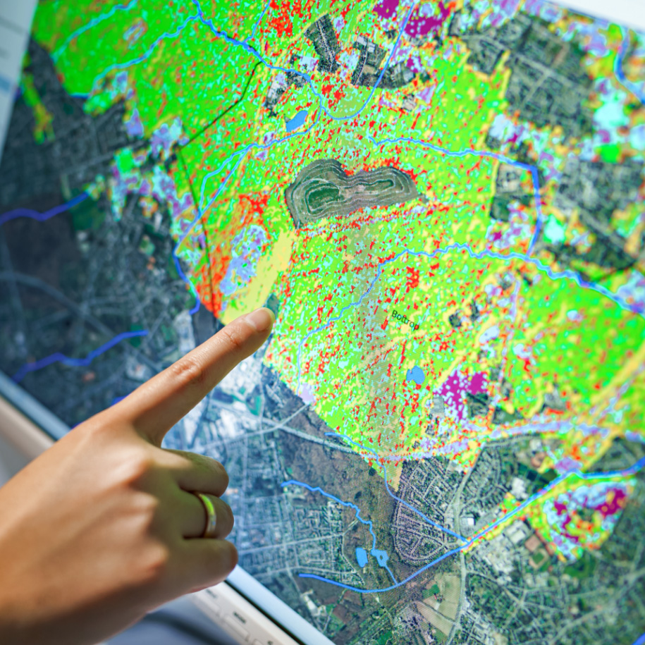
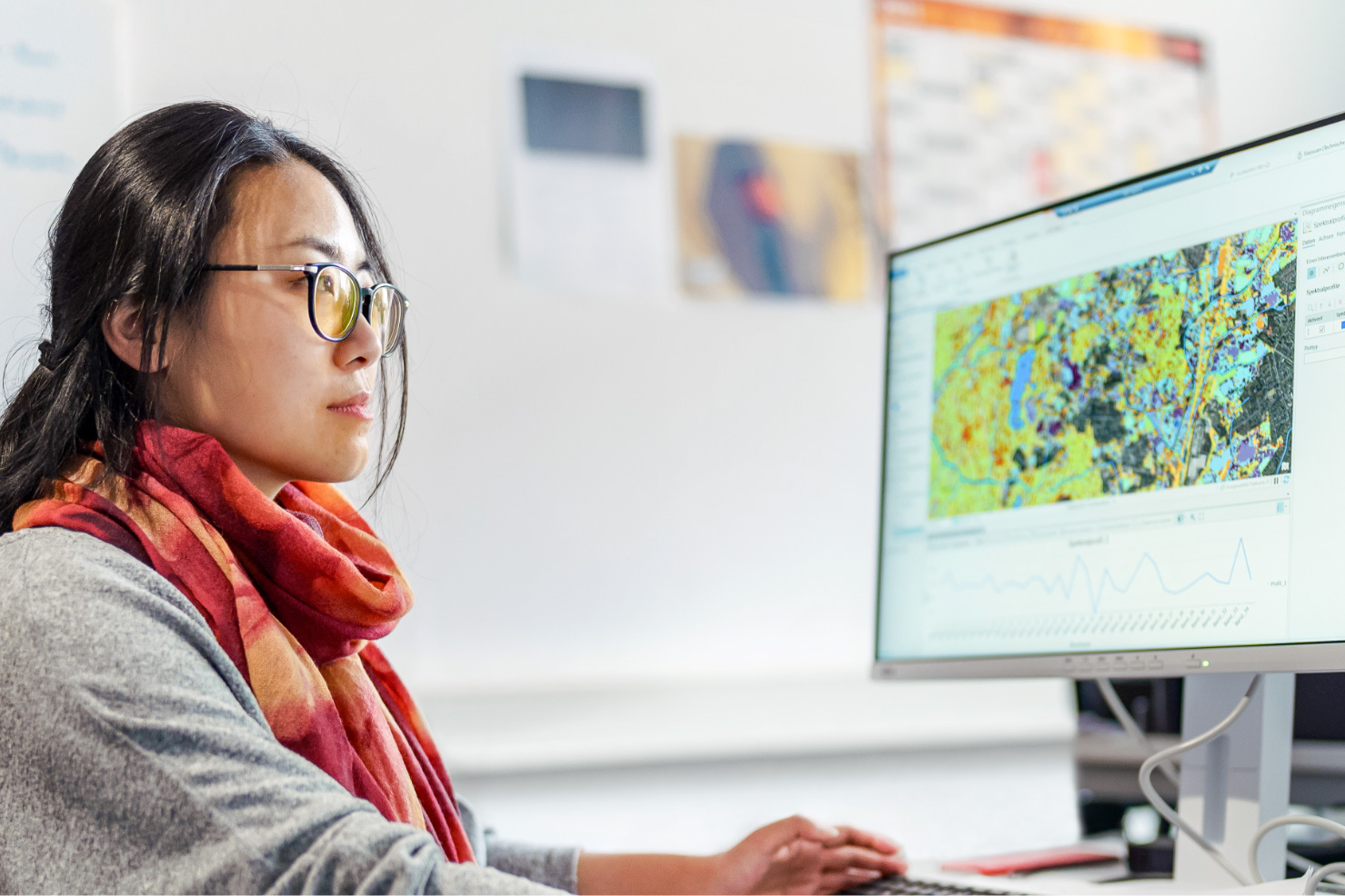
Researcher Dr Xiaoxuan Yin uses satellite data to map changes in the water balance of the Ruhr region. © THGA/Volker Wiciok
‘We use ground sensors and drone imagery to make comparisons with remote sensory data from the Copernicus satellite programme. In doing so, we are able to detect changes in the water balance and their effect on the environment.’
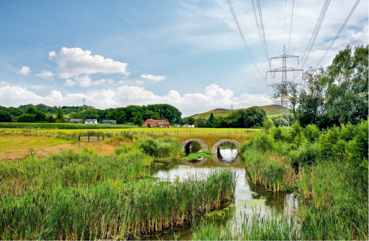
Renaturation through water management
Thanks to the optimisation of the water management, the Boye, a tributary of the Emscher river, has returned to a nearly natural course. © Alamy
Precisely this long-term observation is crucial for the team of researchers: ‘This enables us to calculate future changes in the water balance and to make recommendations for the long-term use of surface areas and resources. The project thus contributes to improving the environmental conditions in agriculture, forestry and water management,’ underscores Professor Dr Rudolph. The findings of the Research Center of Post-Mining are relevant not only for the former coal mining regions along the Ruhr and Saar rivers and in Ibbenbüren – they can also be carried over to all other regions with similar issues in Germany, Europe and ultimately around the world.
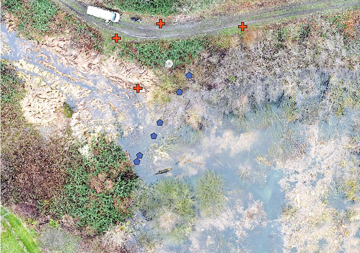
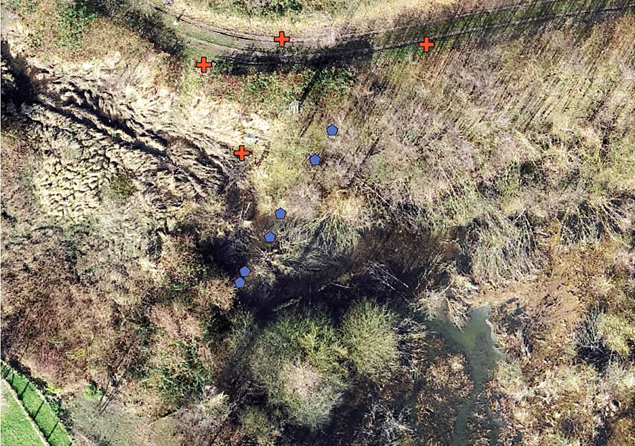
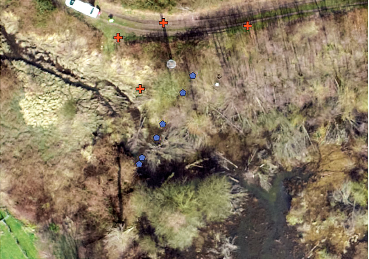
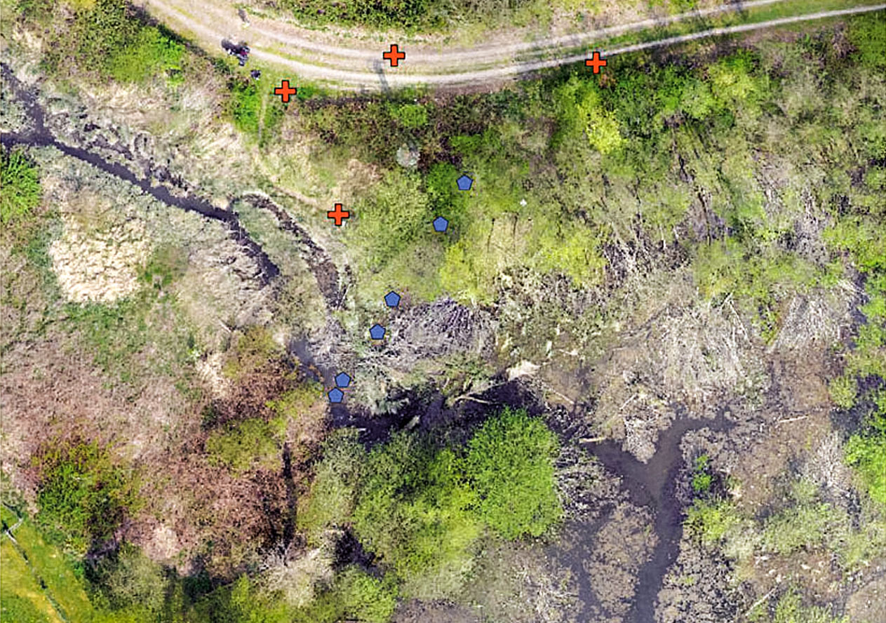
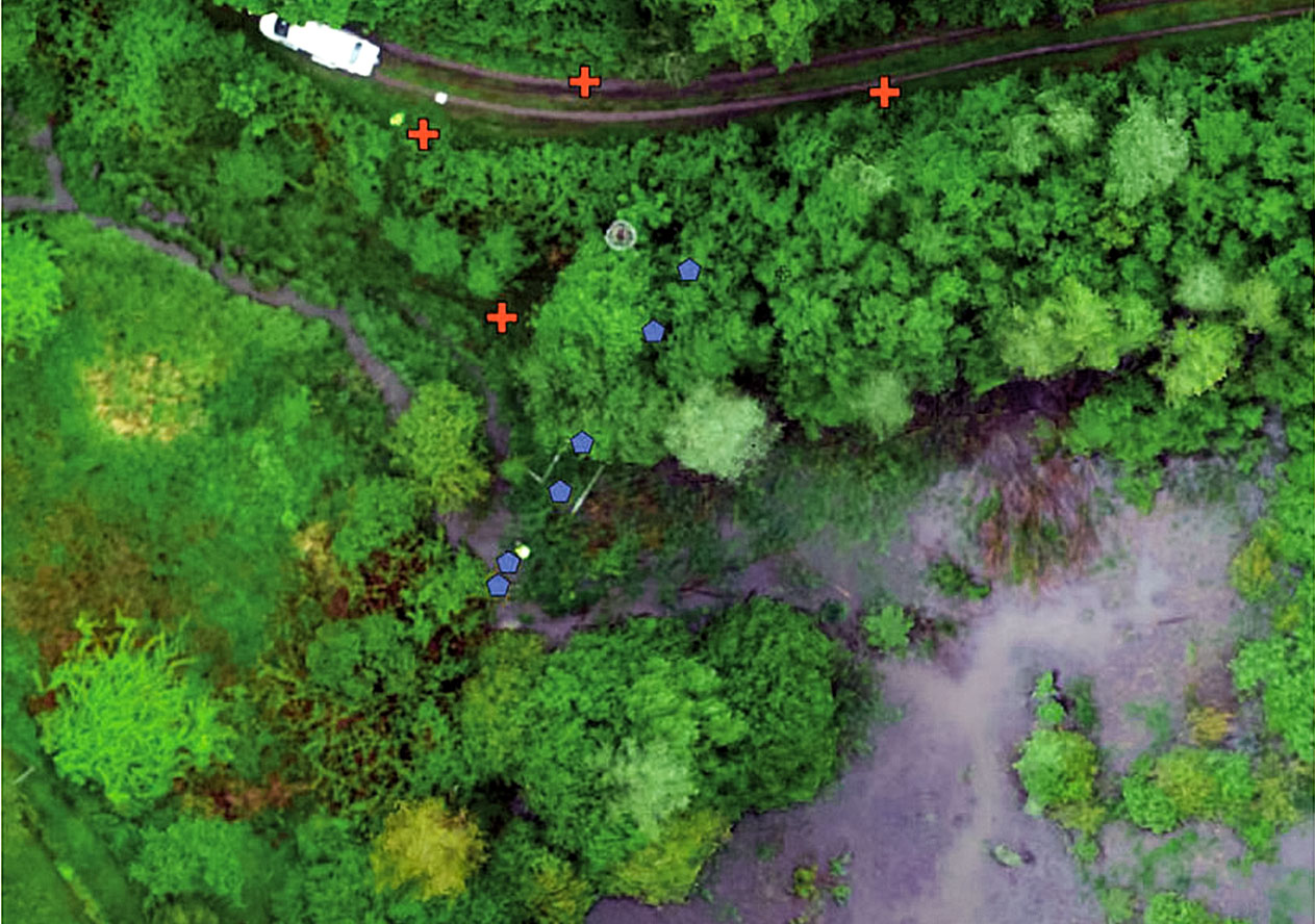
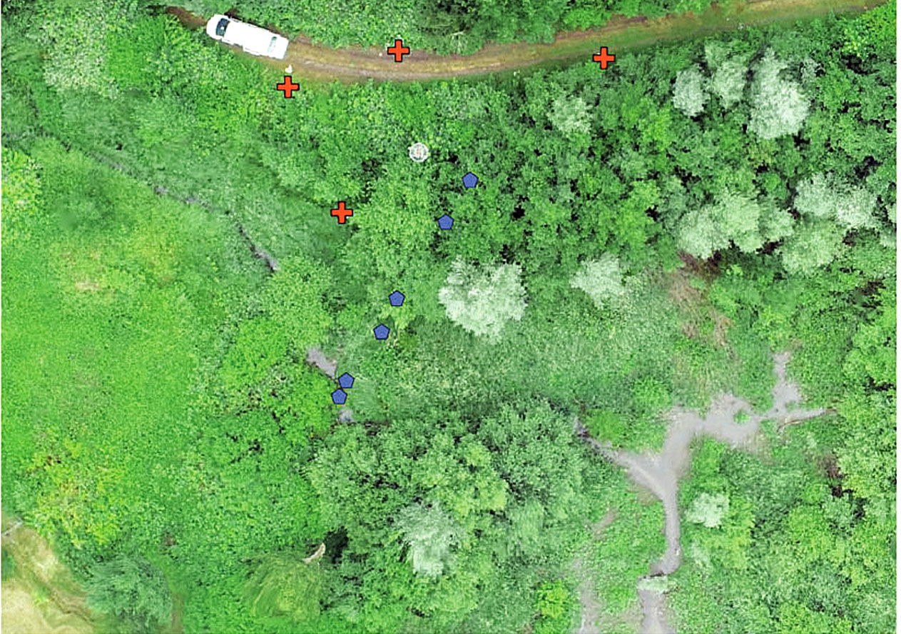
Time-lapse drone photos
The flow of the rivers and the development of the landscape in the protected area along the Boye in Bottrop can be tracked well in chronological order. The blue points mark ground sensors, and the red marks serve as reference points for the aerial photographs. © THGA